Dartmoor Whirlwinds – A Developed Hypothesis
Since it was known that the Dartmoor pair were found in the middle of the South Moor and not near Bovey Tracey, the assumption has largely been that Kitchener was wrong about his location when he saw the trees and pulled up. It took something of a stretch to establish ‘trees’ on Dartmoor, but things were made to fit. However, gaining an understanding of navigational procedures at the time and working backwards, and with the magic of Google Earth, it now seems very likely that Kitchener was right about his location when he left the flight, but wrong when he stated he ‘thought he saw flashes’.
The other two aircraft continued on. Smith climbed above the regulation 1,500ft and made a QDM request to the only place in range of his TR9D HF radio, and he received a bearing – a simple track to fly to get to Plymouth Roborough,, from where he no doubt intended to strike out for St Eval.
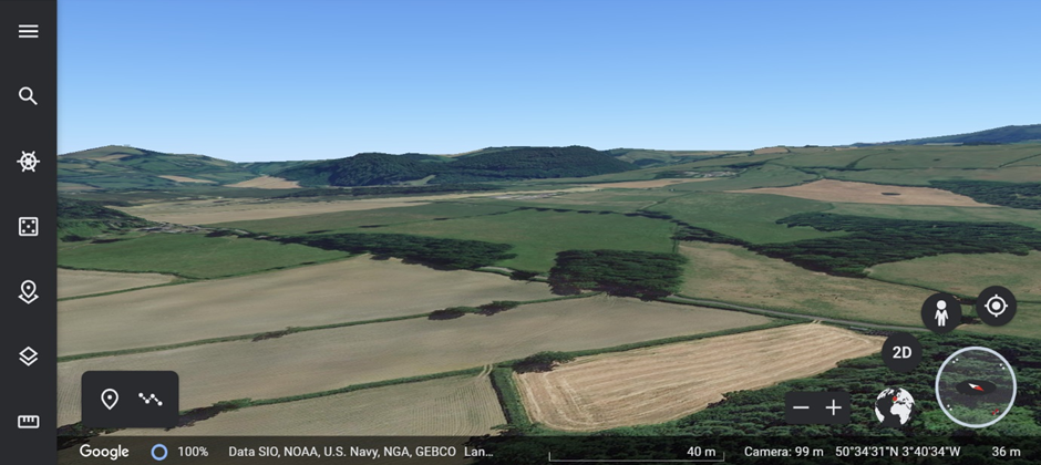
Approx 300ft AGL, (as reported by Kitchener) heading SSW on a course from Exeter Airport, ‘camera’ directly above Bovey Tracey. Note level ground, 50ft AMSL, beneath. The wooded ridge ahead peaks at 450 ft AMSL – approximately ‘camera’ height. Kitchener reported ‘ground rising up immediately beneath him’ and trees.
I would contend that Smith was roughly aware of where he was. He was using the Moretonhampstead and South Devon Railway for navigation – standard procedure at the time. He had to come down below cloud base for visual reference. This was probably always the plan, with a dog-leg flight path using the railway line to skirt South Dartmoor and then fly parallel to the coast.
Bear in mind that only Smith had a map. More likely than not Smith was following the railway below the cloud base – this was a common poor weather navigation method as it guarantees a particular ground level, no sharp turns necessary to track and no sudden rises. He would probably have known where he was and would have used the junction with the mainline at Heathfield, distinctively close to the main road junction, as a way point. Here a turn or a climb would become necessary – why Kitchener carried on towards the rising ground to the SW – and specifically the wooded rise S of Liverton - can’t be known, but he may have lost sight of his leader briefly. The rising ground was 45 seconds from the junction.

No doubt that at the time of Kitchener’s scare - with the reasonable presumption that it happened where the ground suddenly rises SW of Bovey Tracey - Smith would have resorted to the next available aid. This was a ‘QDM’ from Roborough airfield, North of Plymouth. Equipped with an HF ground station with operators used to giving homing bearings to 247 Squadron’s Gladiators, it would have been well within the 35-mile range of Smith’s TR9D radio, while St Eval was way out of range. Kitchener may even have had a planned bearing to Roborough from this point and not even have needed the QDM, but surely would have called out for it to confirm. He would have begun a spiral climb to get enough altitude to contact the ground station, probably also broadcasting a pip-squeak signal as section leader.

Smith would have then led Vine on a compass course towards the Roborough HF DF station (as Pete had already suggested, not Mountbatten - out of range). Even pip-squeak would only have yielded that one bearing, not a triangulated position as only Roborough was in range.
In less than a minute of diverging tracks air-to-air comms, with a 5-mile range as opposed to air-to-ground's 35 miles - would have been lost. It is no surprise that Kitchener reported no conversation. He did say he had a lot of difficulty with the sector controller in Exeter - this is not surprising as sector control would have been busy attempting to plot Smith's position from his pip squeak and voice transmissions and another member of the section also asking for bearings would have initially confused the picture somewhat.
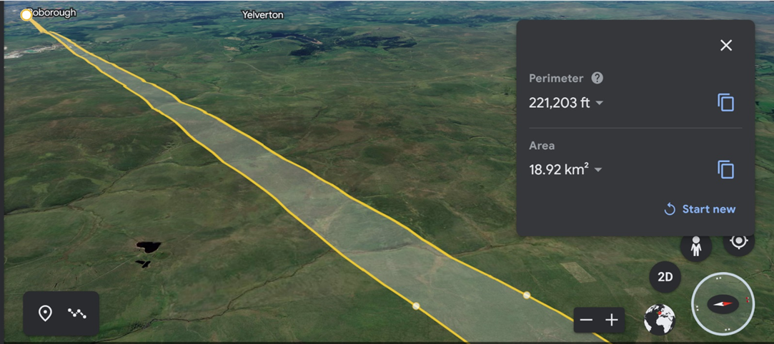
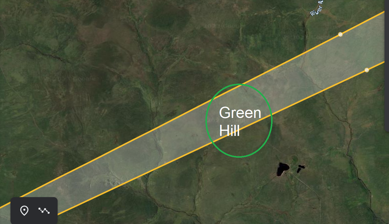
 From the area of the assumed spiral climb to Roborough’s HF DF receiver (previously unrecorded, but which I located on a 1946 aerial photo as a couple of miles North of Roborough airfield), I was able to construct this - a track that cuts right across our area of interest :
But – why did they descend into the moor if Smith had a map?
Smith would have had Sheet 10, SW England. This is from the 1943 edition:
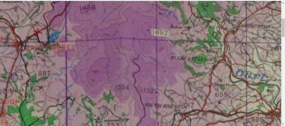
This is tragically simple. The map gives a false impression of the terrain, with no spot height beyond Ryder’s Hill higher than 1,522ft. Smith would have been comfortable with a slow descent on a WSW track once past Ryders, down to 1,550ft for example, based upon the indicated spot heights. The nearest high point to his track appeared to be at 1,324ft. It was a cartographic omission, one that meant the ground rising to over 1,550ft North of Green Hill simply wasn’t properly indicated.
I am sure this was worked out by someone at the time, once the aircraft had been found ‘on a lonely part of the moor’ and not ‘near Bovey Tracey’ – but there was no enquiry.
Another piece of evidence - unearthed by Shamus McAffrey - is the registration of Smith and Vine’s death in ‘Didworthy’. The map above shows the clay works tramway as a black line. Though recently disused at the time, would have been an ideal method of transportation to and from this area, avoiding the many miles of rutted and boggy terrain. At the South end is Didworthy – a hamlet with a sanatorium, complete with doctors qualified to sign a death certificate and - crucially - both an ambulance and a mortuary.
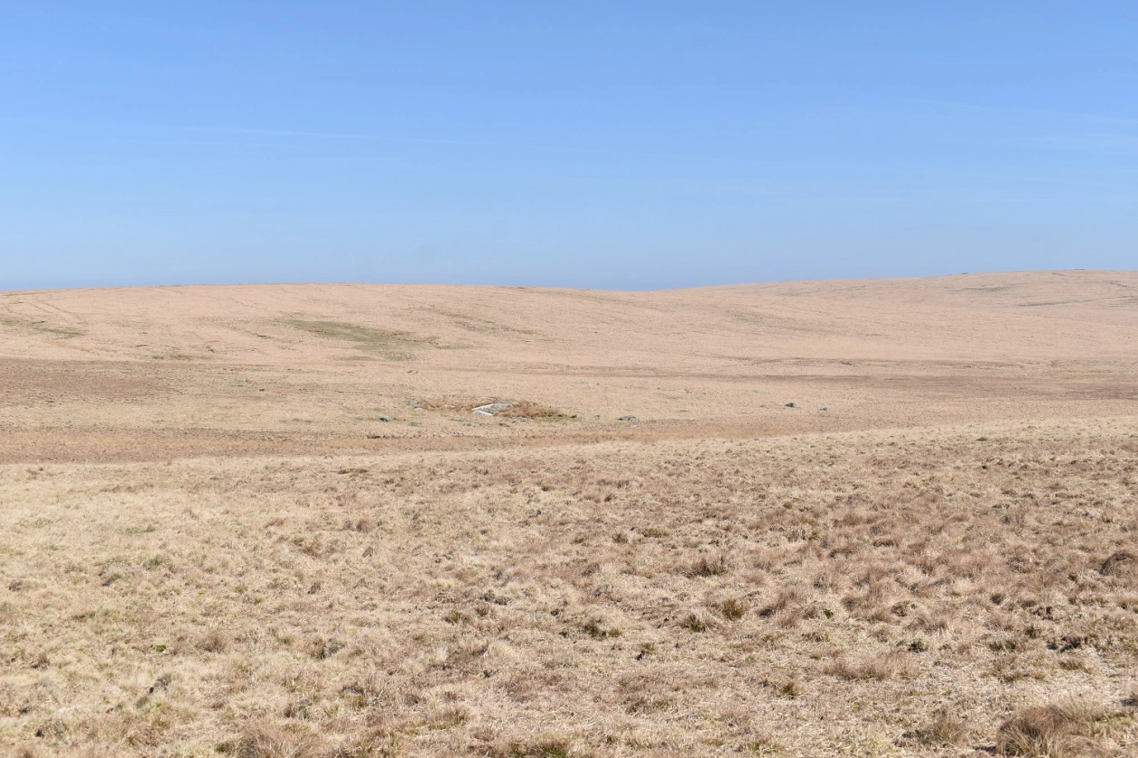
An inspection of several scars in the rising ground to the North East of Green Hill would be my suggestion for the next Dartmoor trip. Volunteers welcome, but be warned - it is always exhausting on the tussocky bog., and its a nine or ten mile round trip to the pub.
MB 01/06/2023